| TRAIL NAME |
NATIONAL FOREST NAME/DISTRICT |
PHONE NUMBER |
STATUS |
DATE UPD. |
Alta Lakes Road
FR623 |
Uncompahgre/Ouray |
970-240-5300 |
Closed |
6/3/15 |
COMMENTS:
6/3/15 - Road still closed per Forest Service. Road opens naturally (not via blade), and is still closed at this time.
|
| |
| Animas Forks |
Uncompahgre/Ouray |
970-240-5300 |
Open |
5/30/15 |
COMMENTS:
|
5/30/15 - Open and dry all the way from Silverton to Animas Forks.
4/15/15- Open, according to the Forest Service.
|
Argentine Pass/Waldorf Mine
FR248 |
White River/Dillon |
970-468-5400 |
Open |
07/6/15 |
COMMENTS:
07/06/15 - Snow blocked the pass near the top, after the Waldorf area. Passable by motorcycle perhaps.
Blocked due to snow near the top, after the Waldorf area in the final ascent. The first snow drift didn't cover the whole trail,
a bike could probably sneak by. Beyond the first I couldn't see, snow may have blocked the rest of the trail.
We made it up McClellan no problem. Lots of running water on trail.
06/14/15 - Argentine Pass and McClellan are both clear up to Waldorf.
|
|
|
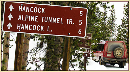
| Alpine Tunnel |
San Isabel/Salida |
719-539-3591 |
Open |
6/21/15 |
COMMENTS:
6/21/15 - The road is open from the Pitkin side. No problems with snow or washouts.
|
| |
| Ballard Road |
Fort Collins Region |
|
|
|
COMMENTS:
|
| |
| Bangs Canyon |
BLM |
|
Open |
4/11/15 |
COMMENTS:
4/11/15 - The Tabeguache Trail in Bangs Canyon is open clear to the dead end just north of Hwy 141.
The trail is very rough with both imbedded and loose rocks of varying sizes. Lots of headshake. A good, challenging trail.
|
| |
| Barbour Forks |
White River/Dillon
Pike/South Platte |
970-468-5400
303-275-5610 |
Open |
6/18/15 |
COMMENTS:
6/18/15 - Ranger district road status page flipped this to open today. Frontrange4x4 group cleanup run tomorrow.
|
|
|
Billings Lake
CR240 |
Chaffee County |
719-539-6961 |
|
|
COMMENTS:
|
|
|
| Bill Moore Lake |
Clear Creek |
303-567-3000 |
Partly Open |
6/27/15 |
COMMENTS:
6/27/15 - Yes, open all the way to the lake - However, there are several spots of snow that MAY require winching on the return (up hill) trip.
The snow is right as you begin the final decent towards the mud bog. Again, it is off camber in spots and does show some erosion
on the edges of the trail so extreme caution should be exercised.
6/24/15 - Trail is clear until you hit a 3ft to 6th snowfield that varies in depth. It is located a few hundred feet before the final hill descent towards the lake.
6/20/15 - Still wet and deep snow drifts past the turn for 183.1C. The rock that used to point out at the inside corner of the
chutes has fallen reducing the risk of body damage. It is now just a steep, loose hill climb. Near the top was a large boulder
in the middle of the chute with a tree that appears near tipping point. With some stacking I was just able to clear the boulder
in my TJ Rubicon with 33's. The boulder was loose so it's position will change quickly.
6/7/15 - Still deep & wet snow drifts past 171.2 and 171.3.
5/24/15 - Trail open, deep wet snow prevents passage past junction of trails 171.2 and 171.3.
Surface was dry and passable in near-stock vehicle up to blockage.
|
|
|
| Birdseye Gulch |
Uncompahgre/Ouray |
970-240-5300 |
|
|
COMMENTS:
|
| |
Black Bear Pass
FR648 |
Uncompahgre/Ouray |
970-327-4835 |
Open |
7/12/15 |
COMMENTS:
7/12/15 - Yes, all the way open traveling through snow drifts at times recently made.
Muddy on top with deep ruts in places. Passable in Wrangler Rubicons with lifts and 35 inch tire size and above in our group.
7/9/15 - Black Bear Pass is Open! 7/9 5:45 pm Black Bear is open From the San Miquel County website. They had a big cat up there today.
7/3/15 - The trail is closed just after 37°53.97414', -107°44.58174', just like the other person said. It doesn't look like it's going to open any time soon, it's DEEP.
6/25/15 - No. I traveled from the Ouray side and was able to drive up to the following GPS coordinates (37.897737, -107.725666)
until I was stopped by a large snow drift. Photos here.
Trail was in good condition. My truck has stock OEM tires and it made up to the snow drift with little problems.
6/21/15 - Telluride side open to top of Bridal Veil Falls only. Large snow bank blocking Black Bear Pass coming downhill to this point.
6/17/15 - Closed according to the Forest Service.
|
|
|
| Blacktail Creek |
Routt |
|
Open |
6/20/15 |
COMMENTS:
6/20/15 - Open all the way. This trail is basically a dirt road, but goes through some beautiful country. There are a few small trees partially blocking the trail, but it is still passable. The wildflowers are in bloom and are beautiful.
|
|
|
| Blowout Pass |
Rio Grande/Divide |
|
|
|
COMMENTS:
|
| |
| Bolam Pass |
Uncompahgre/Ouray |
970-240-5300 |
Partially Open |
6/20/15 |
COMMENTS:
6/20/15 - Traveled east to west. Snow patches just above cabins. Steady snow just as road crests around to northern side. We did not continue.
6/18/15 - Trail is open up to the lake after Greysill Mine. Snow pack covers the pass from that point onward roughly 2-4 feet deep.
6/9/15 - Drove from Durango ski resort to Graysill mine shack.
Trail is still closed
|
|
|
| Boreas Pass |
White River/Dillon |
970-468-5400 |
Open |
6/23/15 |
COMMENTS:
6/23/15 - Have not traveled it yet but just called the forest service and they said it is open all the way.
|
|
|
| Breakneck and Browns Passes (FR175/176) |
Pike/Fairplay |
719-836-2031 |
|
|
COMMENTS:
|
| |
Bunce School Trail System
FR115 |
Boulder |
303�541-2500 |
Open |
6/7/2015 |
COMMENTS:
6/7/15 - Bunce School, Ironclads and T33A were all open with no snow and little water/mud.
04/11/2015 - It's open all the way. I did not see any snow at all. There was very little mud. Generally speaking, it was very dry, and very crowded.
|
| |
| Calamity Mesa |
BLM Grand Junction |
303-239-3600 |
Open |
5/2/15 |
COMMENTS:
5/2/15 - The Calamity Mesa Loop trail is open all the way. This is a class 6+ or 7 trail and is not for full-size vehicles. Wide vehicles won't fit on two obstacles.
|
|
|
| California Gulch |
Uncompahgre/Ouray |
970-240-5300 |
Open |
7/11/15 |
COMMENTS:
7/11/15 - All open all the way. Snow drifts have been plowed.
6/17/15 - Closed according to the Forest Service.
|
| |
| California Pass |
Uncompahgre/Ouray |
970-240-5300 |
Open |
7/7/15 |
COMMENTS:
7/7/15 - Open all the way through! Think it happened within a few days, as the dozer was still at the top of Hurricane
when we went though. We did Corkscrew - Hurricane - California and though the trail was wet in places (It was raining)
it wasn't slick at all.
6/20/15 - Trail out of Silverton by Corkscrew Gulch is still closed.
Trail is blocked by snow several hundred yards from turn to Corkscrew. Has not been plowed.
Could see lots of snow on road from that point.
5/30/15 - From the Silverton the trail is clear to the turn for CorkScrew Pass. From the Animas Forks side the trail is clear
for a few hundres yards to the first mining building. Deep snow (2-4 feet) covers the entire valley.
|
| |
| Caribou Creek |
Boulder |
303-541-2500 |
|
|
COMMENTS:
|
| |
| Carnage Canyon |
San Isabel/Salida |
719-539-3591 |
|
|
COMMENTS:
|
| |
| Cement Creek Road |
Gunnison/Gunnison |
970-641-0471 |
|
|
COMMENTS:
|
| |
| Chalk Mountain |
White River/Holy Cross |
970-827-5715 |
Partly Open |
5/30/15 |
COMMENTS:
5/30/15 - Open tell top of very first hill just to the point of not being able to see the high way, less that .5 mile in.
Mostly dry small run off type areas.
|
| |
| Chihuahua Gulch |
White River/Dillon |
970-468-5400 |
Mostly closed |
6/8/15 |
COMMENTS:
6/8/15 - You can only go 0.6 miles down Chihuahua Gulch until you hit snow right at Peru Creek.
Other than the snow at the Peru Creek, the trail was in great shape
|
|
|
| Chinaman Gulch |
San Isabel/Salida |
719-539-3591 |
Open |
6/7/15 |
COMMENTS:
6/7/15 - Clear and dry all the way through the loop.
|
| |
| China Wall |
Pike/Fairplay |
719-836-2031 |
Open |
5/23/15 |
COMMENTS:
5/23/15 - Mostly open but the China Wall obstacle closed. The drainage in front of China Wall is a huge mud pit with 4+ foot deep mud. Some losers drove through the vegetation next to the mud pit. THIS IS NOT AN APPROVED BYPASS. Do not use this bypass and just wait until someone reports that the mud pit has dried up.
|
| |
| Chinns Lake |
Clear Creek |
303-567-3000 |
Open |
7/12/15 |
COMMENTS:
7/12/15 - Trail is open all the way to both lakes. Difficult rock section at the start of the left fork to the top 3 lakes has been smoothed out and is passable by many more vehicles.
6/17/15 - Trail is blocked by a snow drift right around 10.8k' here.
5/29/15 - Called the ranger station today, they hadn't had a crew up for about a week,
but since they got snow, she stated she didn't know when it would be open.
|
|
|
| Cinammon Pass |
Uncompahgre/Ouray
BLM/Gunnison |
970-240-5300
970-641-0471 |
Open |
6/5/15 |
COMMENTS:
6/5/15 - Trail is open all the way. Trail is wet in many places due to snow melt, but not too muddy.
5/23/15 - Trail open out of Animas Forks until about the 1 mile mark.
Bulldozer has been through but since then an avalanche has blocked the pass with 4' of snow for about 150'
4/15/15 - Open to the top on the Silverton side.
|
| |
Coney Flats
FR507 |
Boulder |
303-541-2500 |
Open |
6/20/15 |
COMMENTS:
6/20/15 - The Coney Flats gate is open at Beaver Reservoir.
The Coney Flats road is clear of snow and downed trees. The Cut Off down to the Middle St. Vrain is also clear of snow
drifts. The water crossing of Coney Creek is high.
6/20/15 - As of 3:40 PM today the trail is officially open, thanks to the TraiLRidge Runners 4x4 club. It may be a few days before it appears open on the forest service site.
Lots of deep puddles. Main water obstacles not as deep as expected. Entrance obstacle by the campground has had work. We removed numerous large downed trees and did some other maintenance.
|
|
|
| Coon Hollow |
BLM Grand Junction |
303-239-3600 |
Open |
5/10/15 |
COMMENTS:
5/10/15 - Steep hogback ridge trail with some deep washes to cross. One wash requires a by-pass. Some severe off camber in several places. Gorgeous views at the top.
|
| |
| Corkscrew Gulch |
Uncompahgre/Ouray
BLM/Gunnison |
970-240-5300
970-641-0471 |
Open |
6/5/15 |
COMMENTS:
6/5/15 - Trail is very wet. There was a thin layer of ice over the trail at the top. There are 2 water crossings on the Ouray side. I got my feet soaked riding a motorcycle. My recommendation is to wait for the trail to dry up.
5/30/15 - Trail is open to the top from the Silverton side.
Trail is freshly plowed. Extremely muddy and slick. Used both front and rear lockers to make it up the final push. The trail looked to be open all the way but I did not proceed down the Ouray side.
|
| |
Cottonwood Pass
FR209/FR306 |
San Isabel/Salida |
719-539-3591
|
|
|
COMMENTS:
|
|
|
| Cumberland Gulch |
Clear Creek |
303-567-3000 |
|
|
COMMENTS:
|
| |
| Cumberland Pass |
San Isabel/Salida |
719-539-3591
|
Open |
6/21/15 |
COMMENTS:
6/21/15 - The trail is open from Pitkin to Tincup. Passed several SUVs and ATVs.
|
| |
| Cunningham Gulch |
Uncompahgre/Ouray |
970-240-5300 |
Partly open |
4/15/15 |
COMMENTS:
4/15/15 - Open to Old Hundred.
|
| |
| |
Dakan Road
CR44 |
Pike/Fairplay |
719-836-2031 |
Closed |
5/23/15 |
COMMENTS:
5/23/15 Impassible mud pit 1 mile north of Ramparte Range Road.
Large mud pit. Someone drove through the forest around the mud pit. THIS IS NOT AN APPROVED BYPASS. Do not use this bypass. Wait until the trail is dry. Someone was there filling the mud pit with logs and branches. This will just make the trail harder to open when the forest service has to pull giant logs out of hard dried ground. Could be a while before this road is usable.
|
| Deer Creek |
White River/Dillon |
970-468-5400 |
Open |
7/4/15 |
COMMENTS:
7/4/15 - The Deer Creek / Saints John loop is open all the way. There is one fairly deep rutted mudhole near the top of the Deer Creek ascent switchbacks up onto the Radical Hill ridge. We had no issues with our '01 Xterra on 33" tires, but watched a Jeep Wrangler struggle a bit.
|
|
|
| Democrat Mountain |
Arapaho/Clear Creek |
303-567-3000 |
|
|
COMMENTS:
|
|
|
| Devil's Canyon |
White River/Dillon
Pike/South Platte |
970-468-5400
303-275-5610 |
Open |
6/18/15 |
COMMENTS:
6/18/15 - Forest service road status page listed this as open today. Frontrange4x4 trail cleanup run tomorrow.
|
|
|
| Eagle Rock |
Teller County |
Near Colorado Springs |
|
|
COMMENTS:
|
| |
| Elwood Pass |
Rio Grande/Conejos
San Juan/Pagosa |
719-274-8971
970-264-2268 |
|
|
COMMENTS:
|
| |
| Engineer Pass |
Uncompahgre/Ouray
BLM/Gunnison |
970-240-5300
970-641-0471 |
Partly Open |
6/12/15 |
COMMENTS:
6/12/15 - Open but subject to temporary closure after a storm. We drove the entire trail from Ouray to Lake City.
Most of the trail is solid and clear of snow even though there is frequently spring runoff on the trail. The side trail to Oh!
Point is quite muddy but we made it with aggressive tires. The 0.4 mile section from Oh! Point to Engineer Pass had been
plowed but a rutted snow base of several inches remains. The warm mid day temps were causing the snow pack to break up and
become heavy slush. At least in the down hill direction it was passable but caution is advised depending on tires,
vehicle and driver experience. On the Lake City side it was muddy for a few tenths of a mile and on one switchback
a couple miles from the pass.
5/30/15 - Trail was reported open to the switchbacks. The recent snow over the past week has drifted and now the trail is impassable about 300 yards past the cut off for Cinnamon on the Silverton side.
5/26/15 = Trail still closed. Headed up out of Ouray, made it up the first couple switchbacks. Huge icey drift is blocking mid switchback. Someone had made it over the drift but since has become so icey that it won't be passable until it is dozed out.
|
| |
| Fourmile Travel Area |
San Isabel |
719-486-0749 |
|
|
COMMENTS:
|
|
|
| Garibaldi Gulch |
White River/Dillon |
970-468-5400 |
|
|
COMMENTS:
|
|
|
| Geneva Creek |
White River/Dillon
Pike/South Platte |
970-468-5400
303-275-5610 |
Closed |
6/14/15 |
COMMENTS:
6/14/15 - No, open up to here.
Blocked by snow at 11,453'.
6/6/14 - Blocked by a large snow drift shortly after the turn-off to the gate entrance to the
Iron Fens. A couple of good rigs and a winch could probably make short work of it, or wait a week
and it will probably be (mostly) gone. Beyond that, who knows, looks like plenty of snow up high.
|
|
|
| Georgia Pass |
White River/Dillon |
970-468-5400 |
Partially Open |
7/4/15 |
COMMENTS:
7/4/15 - Open all the way! Trail from Jefferson to top completely dry. Top of pass heading north on 355 was only wet in a few places - not boggy at all.
7/1/15 - Per the Dillong Ranger Distric on 7/1: The Summit County side of Georgia Pass Rd (S. Fork Swan) #355, approx. ½ mile below pass, has an extremely boggy section that is impassable to most vehicles. We haven't been able to close the road because someone damaged our gate this spring so unfortunately it will be open this weekend. We're working on a temporary solution.
6/23/15 - Trail blocked by hard packed ice/snow at 10,800'. Gates open and trail easily passable up to snow block at 10,800'
6/19/15 - Open just past the second gate. Water crossings are deep, and there is still plenty of snow left to melt. On the run I had to move a downed tree.
Muddy, snowy near where its impassable.
|
|
|
| Gold Hill/Switzerland Trail |
Boulder |
303-541-2500 |
Open |
05/24/2015 |
COMMENTS:
|
5/24/15 - Trail is fully open. There are several large puddles, hundreds of small puddles, and in some places water running
down the ruts. However, 80% of the trail is bone dry and the other 20% is passable. I was on a dirtbike but saw a
few 4X4's doing fine and one Subaru that was stuck.
05/03/2015 - Open all the way, clear and dry.
04/24/2015 - I had to turn back on motorcycle. I believe the trail is open all the way.
Conditions very muddy. I turned back on my dirt bike due to mud. I don't know how passable it is using 4X4, but
I recommend give it some time to dry out.
04/04/2015 - Open all the way. Passable with high clearance 4x4. Still snowy in areas.
|
Goose Creek Road
CR44 |
Pike/Fairplay |
719-836-2031 |
Open |
5/23/15 |
COMMENTS:
5/23/15 Open all the way.
|
| |
| Governor Basin |
Uncompahgre/Ouray |
970-240-5300
970 |
Partially Open |
5/21/15 |
COMMENTS:
5/21/15 - - Traveled to Ruby Trust Mine crossing. Road plowed and dry till other side of river. Trail has had traffic but is snow covered.
Lots of construction from shelf road (car wash) past Camp Bird Mine. Curve at end of shelf road is being widened and drainage culverts are being replace between it and Revenue mine. Traveled to Ruby Trust fork Road wet and muddy snow in places above Ruby Trust Mine.
|
| |
| Granite Creek Canyon |
BLM |
|
Open |
5/24/15 |
COMMENTS:
5/24/15 - Granite Creek Canyon, north of Gateway, is open all the way. The Grand Mesa Jeep Club trimmed miles of thick brush to open it again.
Fairly easy trail except for one creek crossing and the shelf road exit. Great scenery.
|
| |
| Green Ridge Road |
Roosevelt National Forest |
970-498-1100 |
|
|
COMMENTS:
|
| |
| Greer Road |
Roosevelt National Forest |
970-498-1100 |
Open |
5/25/15 |
COMMENTS:
5/25/15 - Greer Road East is open all the way. Greer Road West is open almost all the way, except 1500 yards or so of the last portion
The trail is incredibly muddy and wet. Some eager wheelers have created a mess of the trail with illegal bypasses
|
| |
| Grizzly Lake |
San Isabel/Salida |
719-539-3591
|
Open |
7/10/15 |
COMMENTS:
7/10/15 - Trail is open all the way. Creek crossing near the start of the trail is very difficult.
|
|
|
Guanella Pass
CR62 |
White River/Dillon
Pike/South Platte |
970-468-5400
303-275-5610 |
|
|
COMMENTS:
|
| |
| Gunsight Pass |
White River/Sopris District |
970-963-2266 |
Partially Open |
7/3/15 |
COMMENTS:
7/3/15 - The trail is snow free and open to within 50 yards of the Daisy Mine (about 10,800 feet).
There is a substantial rock slide (I have pictures) at this point with a large rock slab as part of the rock pile. Above the mine there were several snow fields that would be impassable in a vehicle.
|
|
|
Hackett Gulch
FR220 |
Pike National Forest |
Near Colorado Springs |
Open |
6/6/15 |
COMMENTS:
6/6/15 - Open all the way down to Platte River. Trail 50% dry, stream crossings are deep and Platte river very high.
|
| |
Hagerman Pass
FR105
|
San Isabel/Leadville
White River/Sopris |
719-486-0749
970-963-2266 |
Open |
7/4/15 |
COMMENTS:
7/4/15 - Trail open from Leadville through Ivanhoe Lake side. About ten foot snowball on top, which was broken through this past week by Bureau of Reclaimation. Pretty good shape, a bit rocky on spots from Leadville after the ascent from the scone parking area by Carlton Tunnel.
6/25/15 - From Leadville side,I made it within one half mile of the top in an ATV. Large snow bank across road that has a bypass road to left and thru trees. Then the entire top section is under deep snow and not passable. Road is great shape, bladed and gravel put in since I was on it last. Just need at least 2 more weeks of warm sun or someone with a snowplow to get over the top;.DGC
|
|
|
| Halfmoon Creek |
San Isabel/Leadville
White River/Sopris |
719-486-0749
970-963-2266 |
Partly Open |
6/21/15 |
COMMENTS:
6/21/15 - Partial. North branch open to gate before Champion Mill. Deep water crossing just past last Mt Massive trailhead
(1st main water crossing). only took the north branch to Champion Mill. gate was still closed, but trail to that point was open.
5/31/15 - Open just passed both of the first river crossings.
South Halfmoon can only get to the first switch back just passed the river crossing, water depth is around 15in. A lot of snow, up to 6ft deep in the shade.
North Halfmoon probably just over half mile past the first river crossing most of it is on snow one side of trail. DO NOT GO AROUND IT.
Lower parts of trails dry and clear a little mud here and there be respectfully in mud please.
Upper part of trail snow packed mainly on the shaded side, a lot of off camber and deep snow.
STAY ON TRAIL PLEASE.
|
|
|
Hancock Pass
FR295 |
San Isabel/Salida |
719-539-3591 |
Open |
6/28/15 |
COMMENTS:
6/28/15 - Open all the way over from st. Elmo to alpine tunnel.
6/27/15 - The road is passable for all.
|
|
|
Hayden Pass
FR970 |
Rio Grande/Saguache
San Isabel/Salida |
719-655-2547
719-539-3591 |
Open |
6/28/15 |
COMMENTS:
6/28/15 - Some surface water across the road in four areas. Nothing hazardous. Downed trees were cut, potential for scratches if in a wide vehicle.
6/5/15 - From the east side (Coaldale), made it up to 10,200 - perhaps within a mile of the summit. At that point there were numerous fallen trees blocking the trail. Another 200 yards past the fallen trees there were large snow fields over the trail which would have also blocked further driving.
Git 'er Done!
|
| |
| Heart Lake |
Rio Grande
Divide |
719-655-2547 |
Open |
7/6/15 |
COMMENTS:
7/6/15 -Open all the way. One of the best trails in the area. There is one stretch of mud just north of the trail peak.
I went through it (4wd Tacoma) and got thoroughly stuck. Fortunately had other vehicles there to help, but would have been
in a bad place without them.
|
| |
| Hermit Pass |
Rio Grande/Saguache
San Isabel/San Carlos |
719-655-2547
719-269-8500 |
Partially Open |
6/17/15 |
COMMENTS:
6/17/15 - Trail is open to just before Horseshoe Lake where snow covers the trail. It is warm now and the trail will increasingly improve. There is a lot of water flowing in the Sangre De Cristo's, so water crossings are higher than normal for this time of year.
|
| |
| Hidden Valley Trail |
Pike/South Platte |
303-275-5610 |
|
|
COMMENTS:
|
| |
| Holy Cross City |
San Isabel/Leadville
White River/Sopris |
719-486-0749
970-963-2266 |
Open |
7/10/15 |
COMMENTS:
7/10/15 - Trail is open all the way, very muddy and high water at French Creek. Please stay on the trail near the old mud bog right after French Creek.
|
| |
| Hurricane Pass |
Uncompahgre/Ouray |
970-240-5300 |
Open |
7/7/15 |
COMMENTS:
7/7/15 - Open all the way.
|
| |
Imogene Pass
FR869 |
Uncompahgre/Ouray |
970-327-4835 |
Open |
7/7/15 |
COMMENTS:
7/7/15 - Trail is open today, 7-7-2015 per phone call to BLM.
6/17/15 - From the Ouray side the trail has been opened quite a ways, but not all the way to the top yet. A dozer is working on getting through some very large snow fields, with the goal of having it completely open by July 4 or before.
There is still a LOT of snow at high altitude.
6/17/15 - The county reports that it is open to the town of Tomboy.
|
| |
Independence Pass
CO82 |
Park County |
|
Open |
6/1/15 |
COMMENTS:
6/1/15 - Open for the summer.
|
| |
| Independence Trail |
Canyon City |
|
|
|
COMMENTS:
|
| |
| Iron Chest |
San Isabel/Salida |
719-539-3591
|
Open |
7/7/15 |
COMMENTS:
7/7/15 - Trail is open all the way.
|
| |
| Italian Creek Road/Upper Reno Divide |
Gunnison/Gunnison |
970-641-0471 |
Open |
7/12/15 |
COMMENTS:
7/12/15 - From Taylor park, the #642 shelf road is narrow in places due to fallen boulders. there has been a rockslide near the top that has made the trail extremely treacherous. Loose slide rock and boulders required winching a 2 door jk on 35s to keep from rolling off the shelf road.
7/6/15 - Trail is open all the way. Our group removed the obstructing tree on the Cement Creek side and used it to block the illegal
'go-around'. Remember to TreadLightly! folks.
7/5/15 - Open all the way. A tree is blocking the trail about half way through Lower Reno Divide. The bypass is muddy, slick and off camber, but easier traveling from the Crested Butte side. Traveling from the Taylor Park side, the bypass would be more difficult, especially for full sized rigs.
|
| |
| Jenny Creek Trail |
Clear Creek |
303-567-3000 |
Partially Open |
6/23/15 |
COMMENTS:
6/23/15 - Got about 2-2.5 miles. Lots of snow still. I am sure the top drift is pretty large.
New trail is different but VERY well marked
|
| |
| Jones Pass |
Clear Creek |
303-567-3000 |
Partially Open |
7/14/15 |
COMMENTS:
7/14/15 - Trail is now snow free to the 12,100 ft mark, but it may be some time before the last few hundred feet to the pass are clear-lots of deep snow.
6/22/15 - The gates are open, but impassable once you get above the tree line. (10,800 feet?) Snow is still blocking the way.
The trail is in excellent shape up to 10,000. Above that it's in good shape. It's mostly dry.
05/03/15 - No. Still closed/snowed in at the winter trailhead. Not a significant amount of snow on the trail to the Butler/Jones split so with a period of sun and warmth it shouldn't take long. Above the split up to the clearing & switchback between 10,800' and 11,000' some melted, some deeper drifts. Did not travel on the road above 11,000' but looking at the drainage from above, it's well covered at treenline and above.
|
| |
Kebler Pass
CR12 |
Paonia; |
970-527-4131 |
Open |
5/21/15 |
COMMENTS:
5/21/15 - Kebler Pass is open for the summer season at 4pm. Freshly plowed and graded
|
| |
| Kelly Flats |
Canyon Lakes |
970-295-6700 |
Open |
5/30/15 |
COMMENTS:
5/30/15 - Trail is open.
|
| |
| Kendall Peak and Kendall Mountain |
Uncompahgre/Ouray |
970-240-5300 |
Partially Open |
6/20/15 |
COMMENTS:
6/20/15 - Trail is open for about 3 miles.
Then deep ruts from runoff, still flowing lots of water. Had to straddle them to keep going. Had to turn around at spot where road is washed out on one side.
|
| |
| Kennebec Pass |
San Juan Public Lands |
970-247-4874 |
Open |
6/27/15 |
COMMENTS:
6/27/15 - Open to the pass, no problems. Trail from the pass parking area to the notch was NOT open, as a significant snow drift was covering most of the length of the trail.
Slightly muddy in a few places as usual this time of year.
|
| |
Kingston Peak
FR353 |
Clear Creek |
303-567-3000 |
Partially Open |
7/4/15 |
COMMENTS:
7/4/15 - The gate is still closed to this trail. I'm told there is still big snow drifts.
6/23/15 - Started in Idaho Springs, made it to the gate just before the Rock House. The gate is still locked until 7/15/2015 per the sign on the gate.
Coming from Idaho Springs the trail was in great shape, dry as can be, not water or mud, etc. Very easy drive to the gate. Hiked past the gate to the Rock House and the trail was in the same shape to that point and as far as we could see.
|
| |
| Lamartine/Saxon Mountain |
Clear Creek |
303-567-3000 |
Open |
6/13/15 |
COMMENTS:
6/13/15 - The trail is open all the way to the top. We busted through the snow near the top.
The rockslide keeps tourists off this trail. There are a few spots where boulders have rolled onto the trail and you have to drive on the inside to get by.
|
| |
LaSalle Pass
CR44 |
Pike/Fairplay |
719-836-2031 |
Open |
5/23/15 |
COMMENTS:
5/23/15 Spent a an hour cleaning trees. Ground is very saturdated from rain causing trees to fall, but solid enough to make it through.
|
| |
Last Dollar Road
FR638 |
Uncompahgre/Ouray |
970-327-4835 |
Open |
7/08/15 |
COMMENTS:
07/08/15 - Open all the way. A few spots of mud but all have hard gravel under the mud.
5/24/15 - Open to 10,000 ft approx 8 miles from Hwy 62 turn off
Trail gets very muddy and slick after CR68P turn off. At the 10,000 ft area trail is snow covered and some one has gone on. We turned around as snow was over 6" deep and it was sleeting making trail slicker.
|
| |
| Lead King Basin |
White River/Sopris District |
970-963-2266 |
6/21/15 |
Open |
COMMENTS:
6/21/15 - Only a few small snow patches at the top. Creek crossing is nothing to worry about unless you are wheeling in a Miata.
4/30/15 - Not open yet, but Lead King is unaffected by the rockslide that has closed Schofield Pass.
|
| |
| Left Hand Canyon |
Boulder |
303-541-2500 |
|
|
COMMENTS:
|
| |
| Lime Creek Trail |
Uncompahgre/Ouray |
970-240-5300 |
Open |
6/28/15 |
COMMENTS:
6/28/15 - No issues on Lime Creek. Ran in a stock Xterra.
|
| |
| Loch Lomond |
Clear Creek |
303-567-3000 |
Partially Open |
6/21/15 |
COMMENTS:
6/21/15 - This trail has two gates. the first one is open, the second one is not. Parking is limited at the second gate. From the second gate to the lake is about a mile hike up the road. Road is snow covered in patches all the way to the lake. Lake has some ice still on the surface
Trail was a bit rocky, but nothing that a stock 4WD could not handle.
|
| |
Longwater Gulch
FR221 |
Pike National Forest |
|
|
|
COMMENTS:
|
| |
Lost Canyon
|
Leadville
Sopris |
970-963-2266 |
Open |
6/29/15 |
COMMENTS:
7/4/15- From Granite, road is open all the way to the top, at 12,500'. No snow on road but plenty of mud and big rocks on top portion. Great views from top.
6/29/15 - Snow across the trail at 12,250'. Passable.
Snow across the trail at 12,375' - not safe to pass in my opinion. The snow is 8" deep and if you start sliding you could wind up 50 yards down.
BUT...it's only a 200 yard walk from that point to a beautiful lookout over the valley and twin lakes.
Past this second snow field, it appears that all side trails and the trail to the summit are open.
6/20/15 - Not open all the way. Got 6.1 miles from the 399/398 intersection (elevation 11900 ft msl).
Ran into scattered snow drifts 3-6 inches thick that crossed the road. Due to the off camber road and the soft saturated soil that I did not want to tear up, I decided to turn around. Another couple of weeks and the snow should be gone.
|
|
|
| Maggie Gulch |
Uncompahgre/Ouray |
970-240-5300 |
Partially Open |
6/17/15 |
COMMENTS:
6/17/15 - Open to about the halfway point.
|
| |
| Mammoth Gulch |
Boulder |
303-65533;541-2500 |
|
|
COMMENTS:
|
| |
Marshall Pass
CR200 |
San Isabel/Salida |
719-539-3591
|
Open |
6/14/15 |
COMMENTS:
6/14/15 - OPEN all the way. Traveled from Sargents to US 285 on Poncha Pass.
West side was a bit still spongy (rode by 1200cc GS motorcycle). Rain diverting humps had some mud holes on up hill sides
but nothing other than pothole size. Summit has large mud puddle in the rock cut section, but is only a few inches deep.
The by pass at the summit still had a couple drifts covering 1/3 of the road surfaces, with loose baby head rocks but easily
doable. Many down trees on the east side of the pass road. All have been minimally cut through and passable with car or truck.
6/6/15 - From the east side (Mears Junction) drove all the way to the top. At the top there is still a snow drift over the trail blocking any further driving in that direction.
Git 'er Done!
|

|
| McAllister Gulch |
White River/Holy Cross |
970-827-5715 |
Open |
7/1/15 |
COMMENTS:
7/1/15 - Trail open all the way.
Trail open all the way to Resolution Mt. From camp hale in good shape and dry. But crossing Wearyman creek FS 747 is now part of creek. Traveled 30-40 yards and backed out. Possibly washed out before Shrine pass road.
So either turn around at Resolution or make the entire trek thru Ptarmigan Pass.
|
| |
| Medano Pass |
Rio Grande/Saguache
San Isabel/San Carlos
National Parks |
719-655-2547
719-269-8500
719-378-6399 |
Open |
6/26/15 |
COMMENTS:
6/23/15 - Open and dry.
5/30/15 - Gate still locked at north end of trail. Took 412 instead, beautiful conditions, perfect for camping. Only small isolated mud holes.
|
| |
| Metberry Gulch |
Teller County |
|
Open |
6/6/15 |
COMMENTS:
6/6/15 - Trail open all the way down to river.
Trail is Very muddy in some sections. People created an unapproved bypass and blocked off second mud pit with logs in road. The majority of the trail has many washouts and some sections have to strattle logs to pass. Conditions are wet.
|
| |
Middle St. Vrain
FR114 |
Boulder |
303-541-2500 |
Open |
6/20/15 |
COMMENTS:
6/20/15 - The Middle St. Vrain gate is now open. The Middle St. Vrain road is clear of snow and downed trees all the way to
the Middle St. Vrain trail head at the Wilderness boundary.
6/20/15 - As of 3:40 PM today the trail is officially open, thanks to the TraiLRidge Runners 4x4 club. It may be a few days before it appears open on the forest service site.
Lots of deep puddles. Main water obstacles not as deep as expected. Entrance obstacle by the campground has had work.
We removed numerous large downed trees and did some other maintenance.
5/30/15 - Not open, gate closed at entrance.
|
| |
| Mill Creek/Red Elephant Trail |
Arapaho/Clear Creek |
303-567-3000 |
Open |
6/24/15 |
COMMENTS:
6/24/15 - The Mill Creek loop is snow free.
6/20/15 - Ran Mill Creek clock wise, making it all the way around. About half way through is a very deep snow drift, however there is a well worn bypass over old mine tailings that allows you to continue.
Creek crossings appeared to be deeper than normal, I would estimate them at 18 inches and running fast.
Some mud holes on the trail, but they have solid bottoms.
6/18/15 - Went clockways on Mill Creek and only made it about 1/2 way until we encountered snow drifts too big to get thru.
Red Elephant - talked to a guy that ran it on 6/13 and made it up until about 200 yards from the top and too much snow to continue, had to turn around and go back down.
|
| |
| Miller Rock |
Boulder |
303-541-2500 |
|
|
COMMENTS:
|
| |
| Miner's Gulch |
Clear Creek |
303-567-3000 |
Open |
6/21/15 |
COMMENTS:
6/21/15 - Trail is primarily dry. Small patches of trailside snow.
|
| |
| Minnie Gulch |
Uncompahgre/Ouray |
970-240-5300 |
|
|
COMMENTS:
|
| |
| Moody Hill |
Canyon Lakes |
970-295-6700 |
Open |
6/28/15 |
COMMENTS:
6/28/15 - Trail open all the way to quarry and to Crystal Mountain Rd. Great shape and very pretty with all the moisture this summer.
|
| |
| Moon/Gamble Gulch |
Boulder |
303-541-2500 |
|
|
COMMENTS:
|
| |
| Mosquito Pass |
Pike/South Park
San Isabel/Leadville |
719-836-2031
719-486-0749 |
Partially Open |
7/9/15 |
COMMENTS:
7/9/15 - Not Passable. Came up from Leadville. There is deep snow about 75 feet long covering the trail just past the summit marker. Should be gone enough to bash through soon...
6/26/15 - Partially open on the Fairplay/Alma side. Traveled the road on a dirt bike. The road is open and dry to the London Mill.
Once past the mill, and just at the first switchback, the road gets much more rough and steep with a lot of water/snow melt
coming down the rocky roadway. Four wheel drive and high clearance needed from this point on. The road is open to the last
switchback just before the London Mine. (approx. 100 ft from the mine.) The snow banks are covering the trail and is not
passible beyond this point. Should be open to the summit by about July 20th. There is still a lot of deep snow up there.
The snow bank at the mine was probably 10 feet deep and 2-3 feet deep on the roadway.
6/26/15 - From Leadville side, you can get about 2 miles up the pass from the Diamond mine and Diamond Mine sign (Where the road becomes 4x4). Road very rough and rocky. Muddy in spots. Washed out bad in center of road at upper part. I made it an ATV to the 3rd switchback, which is the last one. Really a bad spot until snow melts. Off camber, steep, and a rollover puts you into the slushy snow here, so I turned around. Need about 1-2 weeks of warm weather to melt the upper snow. I turned around at 12,630 feet.DGC.
5/31/15 - Road is still closed/snow packed on the gravel road before the mine on the Leadville side.
All surrounding roads are deep snow as well from what I saw.
SNOW, SNOW, SNOW, and a lot of it.
|
| |
Mount Antero
FR277/278 |
San Isabel/Salida |
719-539-3591
|
Partially Open |
7/11/15 |
COMMENTS:
7/11/15 - Clear until last switchback. Still covered with snow. Final walk to top is snow covered.
7/2/15 - Dry almost until the saddle, snow there, but not much. It should be gone in a few weeks. There is an illegal bypass, but I will not take those. Great trail. Amazing views! Have fun and be safe.
Two smalll creek crossing, but nothing crazy. First one was the larger than the second. After the first creek crossing it a little challenging but my TJ with a 3 inch lift and 33s had no problems. The switchbacks are awesome, but people afraid of heights will not enjoy them!
|

|
| Mount Baldy/Captain Jacks |
Pike National Forest/ El Paso County |
719-836-2031 |
|
|
COMMENTS:
|
| |
| Mount Blanca/Como Lakes |
Rio Grande/Saguache |
719-655-2547 |
|
|
COMMENTS:
|
| |
| Mount Bross |
Pike/South Park |
719-836-2031 |
|
|
COMMENTS:
|
| |
| Mount McClellan |
Arapaho/Clear Creek |
303-567-3000 |
Open |
6/14/15 |
COMMENTS:
6/14/15 - Argentine Pass and McClellan are both clear up to Waldorf.
|
| |
| Mount Zion |
San Isabel/Leadville |
719-486-0749 |
Open |
6/25/15 |
COMMENTS:
6/25/15 - From north of Leadville, road is in great shape and open all the way to the top. Some snow drifts across road but can be driven thru, except the one I buried the ATV in and had to dig out. Even it is now open. Upper part of road very rough and rocky across the high ridge, but views are worth it at the top. Road ends at 12,318 feet. Caution, dont drive this road if lightning is present as the last 4 miles are across the open tundra with full exposure to the elements.DGC.
5/30/15 - Open at about 1mile in. Good trail for a quick day gets up high enough to see turquoise lake and all the mountains, beautiful scenic drive.
|
| |
| Napoleon Pass |
San Isabel/Salida |
719-539-3591 |
Open |
7/10/15 |
COMMENTS:
7/10/15 - Open all the way. No snow, but plenty of deeps ruts in the trees on Tincup side.
|
| |
| No Name Gulch |
White River/Holy Cross |
970-827-5715 |
|
|
COMMENTS:
|
| |
| North Fork Reservoir Road |
San Isabel/Salida |
719-539-3591 |
|
|
COMMENTS:
|
| |
| Ohio Pass |
Gunnison |
970-641-0471 |
Open |
7/2/15 |
COMMENTS:
7/2/15 - Ohio Pass is open and dry all the way.
6/7/15 - Coming from Crested Butte you can make it up Rt 12 to the branch off for Ohio Pass, but within 2 blocks there is snow blocking the way...
|
| |
Ophir Pass
FR630 |
Uncompahgre/Ouray |
970-327-4835 |
Open |
6/28/15 |
COMMENTS:
6/28/15 - Ran Ophir Pass from 550 to Ophir in Stock Xterra. A few ankle deep water crossings and one a little deeper. Lower exp motorcyclist may have problems coming from Ophir side, due to scree on road. We saw one bike wipe out and about three more turn around and go back down. Others made it without issue though. Just use your judgement.
6/18/15 - The pass has been plowed and is clear. Large snow bangs rise up on each side of the vehicle from the summit down into the town of Ophir. Run off has created a couple deep ruts in the road but were passable in a stock Wrangler TJ.
6/12/15 - San Miguel County reported it is open all the way but slick and icy on top.
4/15/15 - Open to the top on the Silverton side.
|
| |
| Otto Mears Toll Road |
San Isabel/Salida |
719-539-3591
|
Partially Open |
6/5/15 |
COMMENTS:
6/5/15 - This trail is also known as Toll Road Gulch. It is forest service road 201.
From the north/east side (Shirley), made it up to almost 11,000 feet before running into snow fields that couldn't be crossed.
|
| |
| Owl Creek Pass |
Uncompahgre/Ouray
BLM/Gunnison |
970-240-5300
970-641-0471 |
Partially Open |
6/7/15 |
COMMENTS:
6/7/15 - Came from east side made it to with in view a courthouse rock.
Trail not open. There are three large deep snow fields with some attempts to breaking through.
Looks like some made it halfway through the smaller snow field and changed their mind.
5/24/15 - Plowed and open past summit. Trail is open and plowed. Muddy and wet with snow falling as night fall caught
us with a dead GPS. Sleeping rock are has two to four feet of snow in the area.
5/20/15 - Per BLM Montrose field office:
Open to Silver Jack camp grounds. Muddy and snow covered. Pass is not open! Camp ground opened on 5/19/15
|
| |
| Pace Lake Road |
BLM Grand Junction |
303-239-3600 |
Open |
5/9/15 |
COMMENTS:
5/9/15 - The Pace Lake road is open to the lake. Expect lots of narrow shelf road, many large rocks imbedded in the road, severe off-cambers, and brush on the roadside.
|
| |
Peak 9 Trail
FR248 |
White River/Dillon |
970-468-5400 |
|
|
COMMENTS:
|
| |
| Peak 10 Trail |
White River/Dillon |
970-468-5400 |
Partially open |
7/8/15 |
COMMENTS:
7/8/15 - Snow blocked path about 3.9 miles from beginning of trail.
Trail was in great condition on ski property, forest property was rougher but also more fun. Snow blocked the path just past the final cabin. It was roughly 3' to 4' deep, looks like it will be there a while. Ran into some hikers, they said the rest of the path was clear however.
|
| |
| Pearl Pass |
Gunnison/Gunnison |
970-641-0471 |
Closed |
6/14/15 |
COMMENTS:
6/14/15 - Snowed in before the pearl pass sign on Montezuma Basin Road. The river crossing was ok. a Subaru made it across the river
|
| |
| Peru Creek Road |
White River/Dillon |
970-468-5400 |
|
|
COMMENTS:
|
| |
| Picayune/Placer Gulch |
Uncompahgre/Ouray |
970-240-5300 |
Open |
6/21/15 |
COMMENTS:
6/21/15 - Open. Traveled from California up through Placer and down Picayune. Placer to the headwall at the top has intermittent plowed/dry sections and then from the bottom of the climb (3-5 switchbacks) to the top it is walls of snow on both sides. Road was in wet but solid conditions. Descent down Picayune was dry, a bit loose but otherwise uneventful.
6/17/15 - Closed according to the Forest Service.
|
| |
| Pickle Gulch |
Arapaho/Clear Creek |
303-567-3000 |
Open |
5/23/15 |
COMMENTS:
5/23/15 - Open all the way.
5/16/ - Not open all the way. The snow drifts are still present just before the shelf road section. Probably doable with a winch and some determination though. Wont be long now.
Trail was pretty sloppy today, lots of water and a few sections are very much washed out, so much so that a few bypasses have been
made. The climb just before the abandoned cabins was pretty tough for my open diffs and 35s - but I made it.
Lots of people were shooting, making a huge mess with their clay targets.
3/25/15 - No. I don't have a mileage, sorry. We made it quite a ways but got stopped by a large, maybe 10 foot high snow drift. Hiking past that showed a few more like it. Two jeeps spent about an hour driving up until we got stopped.
|
| |
| Pinyon Mesa |
|
|
|
|
COMMENTS:
|
| |
| Pole Hill |
Canyon Lakes |
970-498-2770 |
Open |
6/15/15 |
COMMENTS:
6/15/15 - Update! Trail Is Open as of 6-15-15. Please be respectful of housing at the beginning and during the first 1 mile of the trail. Enjoy!
6/7/15 - Gate still closed. Trail goes through my back yard and I see a lot of people coming up to see if its open. The local tour trucks are allowed to open the gate and do the trail so we are getting closer. I will update when they open it.
|
| |
Pomeroy Lake
FR297 |
San Isabel/Salida |
719-539-3591 |
Open |
7/11/15 |
COMMENTS:
7/11/15 - Trail is open all the way.
|
| |
| Poughkeepsie Gulch |
Uncompahgre/Ouray |
970-240-5300 |
Open |
7/15/15 |
COMMENTS:
7/15/15 - Open all the way.
6/17/15 - Closed according to the Forest Service.
|
| |
| Ptarmigan Pass |
White River/Holy Cross |
970-827-5715 |
|
|
COMMENTS:
|
| |
| Radical Hill |
White River/Dillon |
970-468-5400 |
Open |
7/12/15 |
COMMENTS:
7/11/15 - g: Open all the way. Four built Jeeps; we saw minimal snow and loose rock that had fallen.
7/12/15 - We made it all the way from Webster pass to the top of Radical Hill.
On the way up, we ran into some jeeps coming down who said they turned around because of a large, impassable snow field on the trail.
Given we had come this far, we continuted on up. It took a few tries but I made it through the snow field.
The other 5 JKURs in our party had less of a problem getting across. there was snow on the trail higher up, but it was
easily passed.
7/4/15 - Radical Hill is still snowed in at the top. Several long deep drifts blocking the last switchback ascent.
|
| |
| Rampart Range |
Pike/South Platte |
303-275-5610 |
Open |
5/23/15 |
COMMENTS:
5/23/15 - Open all the way.
|
| |
| Red Cone |
White River/Dillon
Pike/South Platte |
970-468-5400
303-275-5610 |
Open |
7/5/15 |
COMMENTS:
7/5/15 - Trail open from 285 to Montezuma. Trail is clear, but rockier than 2014. Fallen trees cleared. Completed route with a stock JK and stock JKU. No problems.
6/27/15 - Mile-Hi Jeep Club has cleared the trail of all debris and snowdrifts. It is clear and the gates are open. You cannot return to highay285 via Webster Pass as there is still a large snowdrift blocking that route. You must exit via the Montezuma side of Webster Pass.
6/19/215 - Still gated.
5/25/15 - Closed and gated. Took forest road up that runs below the trail was fairly deep still but packed and as manageable snow wheeling as you can get.
4/12/15 - Red Cone is the MHJC's adopted trail and we went to check on it on Sunday. We had to lock the gate. There were side by side tracks that were going around snowdrifts and chewing up the dirt where they shouldn't be. Shameful. We made it 1.5 miles past the gate and got stopped by a long off camber snow drift several feet deep. We made it a little ways past the creek crossing. Several drifts 6' deep that we drive over that were frozen still. Lots of downed trees. We cleared some of them and will have to go back with more fuel for the chainsaw. Stay posted for updates on the trail opening or the MHJC FB page should have details when it opens.
|
| |
| Red Canyon Park |
Canyon City |
|
|
|
COMMENTS:
|
| |
| Rollins Pass - East Side |
Roosevelt/Boulder |
303-541-2500 |
Partially Open |
6/28/2015 |
COMMENTS:
6/28/15 - Not open to the top yet. Open to just past Yankee Doodle Lake, where the road cut passes through a notch.
The snow in the notch was still 2-5 ft deep. Because the notch partially shades the road, it may be some time before
it melts enough to allow passage. Just beyond this there is another long drift covering the entire width of the road,
though this is in an more open area, and may melt sooner. Hiked up to Jenny Lake and the road was dry and passable
other than the 2 drifts noted above. Did not go past Jenny Lake, unsure of conditions beyond that.
6/21/15 - Trail is clear up until about 1.5 miles before the first lake.
The first snowdrift is about 1.5 miles from the lake, immediately followed by another larger drift.
These two drifts are passable with a good rig, but lockers would probably be required for the second one.
If you get past these, the road is mostly dry up until just before the first lake, where another large drift
completely blocks the road. Buggies and quads could get over this one, but most vehicles will get stopped here.
If you do make it over, the rest of the trail after the lake is still impassible due to off-camber drifts over the entire road.
6/20/15 - No, at 10K feet. There was a large snow bank that was not passable on MC or jeep, I would expect at 10K feet.
Climbing to the top, tne next blockage had a pretty severe drop off the other side.
3/25/2015 - There is a good amount of snow that we got through. Our smallest rig was a lifted Jeep TJ on 35's and locked front and rear. We had to winch a couple of times. The snow was soft and was packing down really well. We made it across several drifts that were up to a few feed deep and we only sank in maybe 12". We spent some time playing in the big puddle at the first hard left switchback. We made it a ways past that but got stopped on a long uphill grade that was drifted maybe 5 feet deep. We never did find the dirt and we had to do a lot of shoveling and winching to get turned around there.
|
| |
| Rollins Pass - West Side |
Arapaho/Sulphur |
970-887-4100 |
|
|
COMMENTS:
|
| |
| Red and White Mountain |
White River/Holy Cross |
970-827-5715 |
|
|
COMMENTS:
|
| |
| Saints John |
White River/Dillon |
970-468-5400 |
Open |
7/4/15 |
COMMENTS:
7/4/15 - The Deer Creek / Saints John loop is open all the way. Mostly dry, a few minor muddy spots.
|
| |
| Santa Fe Peak |
White River/Dillon |
970-468-5400 |
|
|
COMMENTS:
|
| |
| Saran Wrap |
Pike National Forest |
Near Colorado Springs |
|
|
COMMENTS:
|
| |
| Schofield Pass |
White River/Sophris District |
970-963-2266 |
Partially Open |
07/12/15 |
COMMENTS:
7/12/15 - The trail is open all the way. The creek crossing at the top of Devils Punchbowl was running about 15" to 18".
The snow at the bottom of Devils Punchbowl was shoveled out of the way by some Jeepers today. It's still a bit slippery
and there is a small risk of your backend coming around you if you begin to slip....gas not brakes if this happens.
7/8/15 - Pass is open all the way. We looped up from the Paradise side and dropped into Crested Butte. There are a couple spots of snow from avalanches still in the road but it won't be a problem for stock vehicles.
6/29/15 - Not Passable. The usual snow bridge at the bottom of the Punch Bowl is still very intact. The area affected by the rock slide is quite a bit smoother after the repairs
6/27/15 - Open all the way to Paradise Valley from Crested Butte, but headed to the pass from Paradise Valley, there is deep snow across.
about 500 yards in.
6/23/15Trail repairs reported complete here.
06/23/15 - I didn't travel up there personally, but per the Aspen Daily News the rock slide above Crystal has been cleared by USFS. (It's still probably snowed in above that though.)
05/03/2015 - Road is mostly clear up to the upper Schofield/Lead King intersection, with a little snow right around Crystal. (No info on Lead King.)
It gets ugly a couple hundred yards above the Schofield/Lead King intersection. In all, the rock slide is maybe 150 yards long,
on and off (the worst of it over 20-30 yards), with countless large boulders in the road. There are also some deep washouts all
through this section. It'll take a lot of work to see this road open again. A half mile above the carnage is the usual
deep wall of snow, just below the bridge. Photos here.
4/30/15 - Closed on the Devil's Punchbowl area. I have not seen this in person, read it. Looks credible.
If credible, closed for a long time.
2/28/15 = No, not for 4x4's at this time. Hiking with Shoe shoes yes or on snowmobiles maybe.
Deep snow, hiked back into Crystal mill from Marble. Noticed two small avalanches over the road before the mill. Will take some time to clear the avalanche debris after snow melts.
|
| |
| Scotch Creek |
Uncompahgre/Ouray |
970-240-5300 |
|
|
COMMENTS:
|
| |
| Sevenmile |
San Isabel/Salida |
719-539-3591 |
|
|
COMMENTS:
|
| |
| Sheep Creek |
BLM |
|
Open |
5/24/15 |
COMMENTS:
5/24/15 - Sheep Creek is open all the way.
The trail is very rough with loose small and medium round rock littered all over. Some larger rocks near the top. A long, winding shelf road with several extremely sharp hairpin turns near the top. Can be fun, but difficult. People with height issues may not want to go here.
|
| |
| Sheephorn Mountain |
White River |
970-468-5400 |
Open |
6/20/15 |
COMMENTS:
6/20/15 - Open all the way. Completely passable. Beginning from Hiway 9 side, the narrow, steep section between mile 6 and 7 has some water running down it, and there are some mudholes, but easy to get through. East side is very dry and dusty.
|
|
|
| Shrine Pass |
White River/Holy Cross
White River/Dillon |
970-827-5715
970-468-5400 |
Open |
6/25/15 |
COMMENTS:
6/25/15 - Open and dry the entire the way.
|
| |
| Sidney Basin |
Uncompahgre/Ouray |
970-240-5300
970 |
|
|
COMMENTS:
|
| |
| Slate River Road/Paradise Divide |
|
|
|
|
COMMENTS:
|
| |
| Slaughterhouse Gulch |
Pike/South Platte |
303-275-5610 |
Open |
6/20/15 |
COMMENTS:
6/20/15 - Entire trail is open. Had a rainy May, so a bit rockier than usual.
|
| |
| Slide Lake |
White River/Holy Cross |
970-827-5715 |
|
|
COMMENTS:
|
| |
| Spring Creek |
Arapaho/Clear Creek |
303-567-3000 |
Open |
6/20/15 |
COMMENTS:
6/20/15 - Open all the way.
6/6/15 - Made it about 1/4 to 1/2 mile from the rock garden. First one this far. Bashed down quite a few 15" deep sections of snow. Turned around when we got to where it was 2 feet deep. Could be fully clear by the 20th.
Trail was dry all the way up until right before the rock garden, some deep snow drifts.
|
| |
| Stony Pass |
Uncompahgre/Ouray |
970-240-5300 |
Partially Open |
6/17/15 |
COMMENTS:
6/17/15 - Open to Pole Creek which is very high.
|
| |
Summitville Trail
FR250, FR330, FR380 |
Rio Grande/Conejos
| 719-274-8971 |
|
|
COMMENTS:
|
| |
| Swan River Road - Middle Fork |
White River/Dillon |
970-468-5400 |
|
|
COMMENTS:
|
| |
Swan River Road - North Fork & Wise Mountain
FR354 |
White River/Dillon |
970-468-5400 |
|
|
COMMENTS:
|
| |
| Swan River Road - South Fork |
White River/Dillon |
970-468-5400 |
|
|
COMMENTS:
|
| |
Taylor Mountain
CR228/FR330 |
Chaffee County |
719-539-6961 |
|
|
COMMENTS:
|
| |
| Taylor Pass |
Gunnison/Gunnison |
970-641-0471 |
Open |
7/6/15 |
COMMENTS:
7/6/15 - Trail is open all the way. Creek crossing after waterway is getting pretty bad. Would not advise stock vehicle.
|
| |
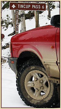
Tincup Pass
FR267 |
San Isabel/Salida
Gunnison/Gunnison |
719-539-3591
970-641-0471 |
Open |
7/7/15 |
COMMENTS:
7/7/15 - Trail is open all the way. You do have to drive through water covering the road at mirror lake but it is only about 1 ft deep.
7/6/15 - The trail is open and being used by ATVs and Jeeps. Some water in Mirror lake is hub deep.
6/20/15 - Mirror Lake is very full, preventing any access from the Tincup side. 4'+ of water on the road. The trail up to Mirror Lake is in great shape.
6/21/15 - The trail is very rugged going up from St. Elmo and the road was not passable at the crest. The snow drift is still covering most of the road.
The entire pass from St. Elmo up to the crest is very rugged. 4x4 and high clearance highly recommend.
|
| |
| Tomichi Pass |
Gunnison/Gunnison |
970-641-0471 |
Open |
7/6/15 |
COMMENTS:
7/6/15 - Open to Jeep and ATV. On 7-1 a full size pickup rolled off the road above Brittle Silver Basin. I only saw photos of the truck. a lot of damage. The truck has been removed now. It is a narrow road and on a steep side hill. A great trail, but pay attention.
|
| |
| Treasure Mountain Loop |
Uncompahgre/Ouray |
970-240-5300 |
Closed |
6/17/15 |
COMMENTS:
6/17/15 - Closed according to the Forest Service.
|
| |
| Turner Gulch |
Pike/Fairplay |
719-836-2031 |
Open |
5/23/15 |
COMMENTS:
5/23/15 Open all the way.
|
| |
| Twin Cone |
Pike, South Platte |
719-836-2031 |
Open |
6/21/15 |
COMMENTS:
6/21/15 - All clear to the top as posted below, but the section with runoff coming down the trail was much less severe than
described below. The "ditch" running down the trail was 2-3 ft wide but only a few inches deep, and had just a trickle of water.
Lots of loose rock on the final steep climb near the top, more than I remember last year, but probably normal given that it is
early in the season and things that moved in the spring melt haven't been smoothed out by traffic yet. No snow whatsoever on top.
6/14/15 - The trail is open all the way to the top.
The trail is open and clear of snow all the way to the top. In between the first and second gate there is a serious amount of water running down the middle of the trail. The water has created a very large and deep wash down the center. It is probably 2-3 feet deep and 2-3 feet wide currently. We were able to skirt the left side of the trail and avoid the washout but with the water still moving very fast through it the wash may become very serious and impassable within the next couple of weeks. They need to get some equipment up there and create a trench across the road so the trail doesn't get washed away entirely.
After the second gate the trail was very good all the way to the top with just a very small amount of snow less than 2 inches
deep for about 50ft near the top. It should be melted within a week.
6/14/15 - Open all the way to the summit and snow free!
6/7/15 - Approx. 6 miles before hitting too much snow. Can make it up past the challenging rock section past first snow field to the flat section by the huge rock feature. Then snow fields block the way.
|
| |
| Uncompahgre Plateau Area |
Grand Valley |
970-242-8211 |
|
|
COMMENTS:
|
| |
| Wager Gulch |
Uncompahgre/Ouray
BLM/Gunnison |
970-240-5300
970-641-0471 |
Open |
7/6/15 |
COMMENTS:
7/6/15 - Open all the way. Some thick mud at several crossings along the trail. We were able to use logs/branches to get through one deep spot. The 4wd suburban in our group completed the whole trail but struggled in the muddy places.
|
| |
| Warden Gulch |
White River/Dillon |
970-468-5400 |
|
|
COMMENTS:
|
| |
| Wearyman Creek (FS747) |
White River/Holy Cross |
970-827-5715 |
Open |
7/13/15 |
COMMENTS:
7/13/15 - Trail update. FS 747 that links Mcallister Gulch and Ptarmigan pass to Shrine pass road is still part of Wearyman Creek for a good portion of the trail. Most has at least water running down the road and several sections have been washed out. Much erosion but all rock, no mud.
It is still passable but was once an easy/moderate link is at least difficult to moderately difficult. Several large rocks to cross, narrow off camber areas where you'll need a good line or risk sliding into the rocks next to you.
I took it in a stock Unlimited Rubicon and got thru. Bottomed out a couple times. Would not recommend for stock low clearance vehicles.
|
| |
| Webster Pass/Handcart Gulch |
White River/Dillon
Pike/South Platte |
970-468-5400
303-275-5610 |
Partially Open |
7/11/15 |
COMMENTS:
7/11/15 - No. From Grant, you can travel all the way to the top, but there is snow pack stopping you from going any further (as of 7-11-15). Probably won't open until 7-31-15. An alternative is the Red Cone trail which is fully open.
A serious issue with the trail on the way up: There is one small section (about 25 feet long) of the pass that has always been narrow, which gets the heart pumping for full size vehicles due to the severe drop off. However, it is now much more dangerous due to two water run-off holes on the side of the drop off. Hugging the side of the mountain, my 2015 JKU found its tires falling into the holes. I quickly gave it gas to keep my Jeep from slipping off the side and plummeting to my death. With any more rain fall, I can imagine these two holes will become larger. The two holes are at the narrowest part of the trail, which of course is the worst location for them to form. I highly recommend that full size vehicles do not attempt Webster Pass until the holes can be repaired (which I think will be very difficult).
Please update the Webster Pass trail page with this important information. ATV's and other small width vehicles will not have a problem, but anything with the width of a Jeep Wrangler JK will find it a very dangerous situation (which will probably become worse).
6/27/15 - Partially open. Webster Pass is clear from Red Cone, down into Montezuma. However, there is still a large snow drift at the top of the Webster saddle preventing traffic from 285 to continue down into Montezuma. Gonna be awhile for that to melt.
4/12/15 - We made it 3 miles past the Red Cone gate turnoff. There was a lot of snow. We made it past the old mine building that's not there anymore. The avalanche area from last year is dry and lots of tree debris still in the area, off the trail still. We got stopped going up a long uphill section of deep snow. Stepping off the trail it was easily still 3' deep. It was that soft kind of sugar snow that doesn't pack very well and turns to ice as soon as your tires spin. Not sinking in too deep in most places, but no traction. We did not make it down Handcart Gulch.
|
| |
Weston Pass
CR7 |
Pike/Fairplay
San Isabel/Leadville |
719-836-2031
719-486-0749 |
Open |
6/29/15 |
COMMENTS:
6/29/15 - Open all the way on the road. West side steep section a bit rough and loose since not much travel over it yet.
I was on my 1200cc bmw gs fully loaded and had no problems.
7/7/15 - Friends report weston is fully open using the established road base.
6/14/15 - Closed at the summit just on the East side. Travel up to snow drift from the east.
Still large snow drift 1-2 ft deep just at the top of the east side. As see in picture in previous conditions post.
The questionable by pass is still very muddy and more rutted from some use.
6/13/15 - From the East (Fairplay side), our group was stopped a few hundreds yards short of the summit by a deep drift across the main road. There is a (questionable?) bypass to access an old side road that will reach the summit, but there are additional drifts West from the summit preventing a complete passage regardless.
Very wet snow with thick mud underneath.
Here is a photo of a late-model Rubicon that
required 2 winches plus digging for recovery after testing the snow from the summit side (after making the bypass):
After making the bypass myself, I got stuck in the snow mud at the top of the drift just attempting a 3 point turn,
requiring a strap pull from another Jeep. Our group also pulled a stock Cherokee from a drift on a side trail below the summit,
so lone vehicles could find themselves stranded if they aren't prepared for self-recovery (which would be near impossible above
tree line.)
6/7/15 - Not passable. About a mile south of Gold Basin, the snow is about 2 feet deep.
|
| |
| Wheeler Geological Area |
Rio Grande/Conejos
| 719-274-8971 |
|
|
COMMENTS:
|
| |
| Wheeler Lake |
Pike/South Park |
719-836-2031 |
Partially Open |
6/20/15 |
COMMENTS:
6/20/15 - No, large snow drift (likely there till August) just a little bit before Bowling Ball Hill.
Trail was wet but in good condition otherwise. The snow blocking the trail was so deep and long that we didn't even attempt to bust it.
|
| |
| Williams Pass |
San Isabel/Salida |
719-539-3591 |
Closed |
6/21/15 |
COMMENTS:
6/21/15 - Williams Pass is only open Aug.1-Aug.31. Gates at both ends are opened 8-1 and closed 8-31. This is an agreement with a 4X4 club in Gunnison County and the Gunnison Forest Service.
|
| |
| Wurts Ditch Road |
White River/Holy Cross |
970-827-5715 |
|
|
COMMENTS:
|
| |
| Yankee Boy Basin |
Uncompahgre/Ouray
BLM/Gunnison |
970-240-5300
970-641-0471 |
Open |
7/6/15 |
COMMENTS:
7/6/15 - Trail is gated about 1/3 mile past the waterfall. This may be normal, as I've not been that high before.
A few tough places at runoff crossings, but nothing difficult if you have high clearance. Trail was pretty rough after the
closed gates, and is only wide enough for a vehicle for a short distance farther anyway. Wildflowers were just beginning to show.
6/5/15 - Trail ends just above waterfall. This was my first time so I'm not sure how much further it goes in Summer. Currently snow is deep where trail ends. Snow shoes required to continue on foot.
Trail is wet in areas but not difficult to pass.
5/31/15 - Trail has been plowed to bathroom in middle of basin above Twin Falls. Road impassable after that point.
Road to plowed end is mostly dry with 2.5 feet of snow on the ground at mid basin.
5/20/15 - Gate at switch back is open, Road is dry to Camp Bird Mine.
Construction work on switch back just past gate. Snow on road at rear of old Mine managers office. ROAD IS IMPASSABLE.
|
| |
| Yankee Hill |
Arapaho/Clear Creek |
303-567-3000 |
Open |
6/21/15 |
COMMENTS:
6/21/15 - Yes (confirmed up to West outlet of Miner's Gulch)
Trail is primarily dry. Some muddy puddles and small water flows on trail. Mud pits are dry. No new or significant change in obstacles but there is notable amounts of erosion on some hills.
|
| |
|
|
|
|
 This is
the page for the 2015 Colorado Pass page. You can add to this page and
This is
the page for the 2015 Colorado Pass page. You can add to this page and


 As a guide, you can view the dates and information from the
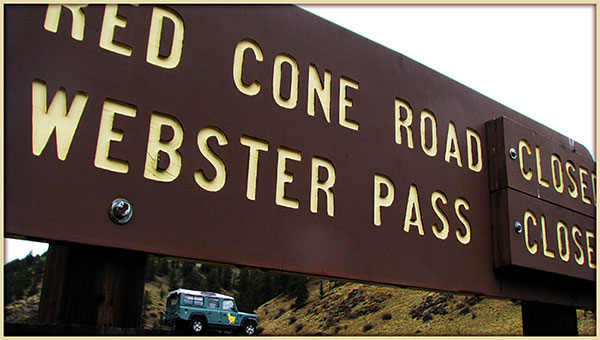